© XAVIER RIBAS - Greenhouse (2007) 2 channel HDV, sound, text. 23 min, looped. Ed of 4 + 2 ap
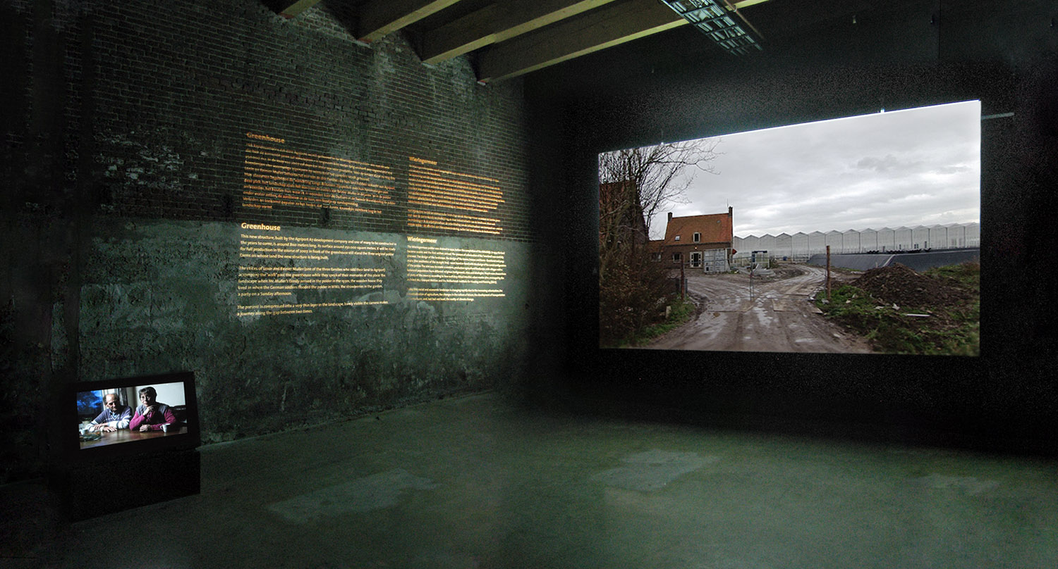
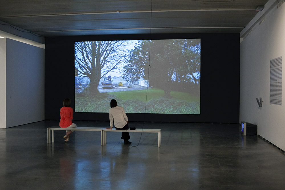
Installation of Greenhouse at the Stedelijk Museum de Lakenhal, Leiden, March 2007. © Photograph: Olga Overbeek
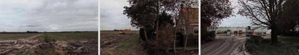
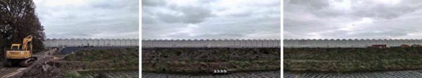
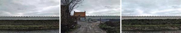
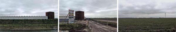
[En] Greenhouse is an installation about the changing landscape of contemporary Holland. It looks at th site of the biggest greenhouse in Europe as it was being built near Medemblik, some 70 kms North of Amsterdam in the polder of Wieringemeer, by the agricultural corporation Agriport A7. The new glass structure is about eight hundred meters long and its surface is around 250.000 square meters. At the time of filming, in the site still stood the three original polder farms from the 1930s (one of them was already abandoned and half derelict) on which land the new structure was being built. The large video screen shows a continuous, unedited, travelling shot from one end to the other of the greenhouse in construction.
The camera scans foreground and background at a slow steady pace, as if by walking, capturing two kinds of buildings, two economies, two mentalities. On the small screen, the Mullers (the last of the three families who sold their land to Agriport) talk about their memories of the place: the landscape when Mr Muller’s family arrived in the polder in the 1930s, a wooden house they lived in when the German soldiers flooded the polder in WW2, the strawberries in the garden, a party on a Sunday afternoon… Their voices accompany us in our ‘walk’ past the greenhouse. They act as an aperture to the past of the place, while we contemplate the making of its future. Past and future compress the present into a very thin layer in the landscape, barely visible. Greenhouse focuses on this landscape in transition; it is a journey along the gap between two times.
----
[Cast] Greenhouse es una instalación sobre el cambio en el paisaje contemporáneo holandés. Cerca de Medemblik, en el polder de Wieringermeer a unos 70 kilómetros al norte de Amsterdam, la corporación Agriport construyó en el año 2007 el mayor invernadero de Europa, una sola estructura de cristal de unos 800 metros de largo y una superfície aproximada de 250.000 metros cuadrados. La proyección muestra un traveling continuo de plano único, sin cortes, de un extremo al otro del invernadero en construcción, donde se aprecian todavía las tres granjas familiares originales de la década de 1930, sobre cuyas tierras agrícolas se levanta el nuevo edificio.
La cámara escanea el paisaje a una velocidad lenta, de caminar, mostrando a la vez dos tipos de edificios, dos economías, dos mentalidades... En el monitor, unos días antes de dejar su casa, Lenie y Reinier Muller hablan de sus recuerdos del lugar: el paisaje cuando la familia del señor Muller llegó al pólder en los años treinta, la casa de madera donde vivieron cuando los soldados alemanes inundaron el pólder durante la segunda guerra mundial, las fresas del jardín, una fiesta familiar de una tarde de domingo... Sus voces nos acompañan en este ‘paseo’ a lo largo del invernadero, abriendo una ventana al pasado del lugar mientras contemplamos su futuro en construcción. Pasado y futuro comprimen el presente en una capa muy fina del territorio, apenas perceptible. Greenhouse nos muestra un paisaje en transición, es un viaje a lo largo de la hendidura entre dos tiempos.
© Xavier Ribas (2007)
This work was produced during an International Photography Research Network (IPRN) fellowship in Holland, hosted by Paradox and the Leiden University.
---
[En] Wieringemeer polder in North Holland was drained in 1930, before the completion of the Afsluitdijk, the dam that connects the province of North Holland and Friesland. The dam closed off the Zuiderzee, a salt water inlet of the North Sea, turning it into the fresh water lake of Ijsselmeer. In 1934 the land became usable and the first settlers arrived. The process of colonisation of the ‘new land’ was well thought out and structured. The design of the landscape, the design of the towns, houses and farms, functional and pragmatic (the aesthetics of the straight line), went hand-in-hand with the design of the social configuration of the polder. The aim was to create a 'productive agricultural landscape with villages', and its urban planning represented a modern way of thinking about agriculture as well as community life. A balanced distribution of religious backgrounds, class and ideologies was set in place. People were chosen from all parts of the country according to how well they fitted into this urban master plan, envisaged by the architect M.J. Granpré Molière and the Netherlands Institute for Housing and Planning (NIVS). Today, this social and economic landscape is changing rapidly due to the growth of urbanization, the industrialization of agriculture, the changes in the culture of leisure, the development of transportation infrastructures, and, last but not least, the reality of climate change. All of this raises the question of how much of this original landscape will remain visible in the near future.
----
[Cast] Wieringemeer es un pólder ganado al mar en el año 1930, antes de completar Afsluitdijk, la presa que conecta las dos provincias holandesas de North Holland y Friesland. Esta presa cerró el Zuiderzee, una laguna de agua salada del mar del Norte, convirtiéndola en el lago de agua dulce de Ijsselmeer. El proceso de colonización del ‘territorio nuevo’ se hizo a partir de un plan de asentamiento diseñado el arquitecto M. J. Granpré Molière y por el Instituto Holandés de Planificación y de Vivienda (NIVS). El diseño del paisaje, de los pueblos, de las casas y de las propiedades agrícolas, siguieron la estética de línea recta, y con un reparto equilibrado de prácticas religiosas, clases sociales e ideologías políticas, se creó un paisaje agrícola con pequeñas poblaciones, respondiendo a una visión moderna de la agricultura y de la vida comunitaria. En 1934 llegaron los primeros campesinos. La gente venía de todas las partes del país. El paisaje económico y social de Wieringemeer está cambiando rápidamente como consecuenciadel crecimiento urbano, la industrialización de la agricultura, los cambios en la cultura del ocio, el desarrollo de las infraestructuras de transporte y la realidad del cambio climático. Todo ello plantea la cuestión de qué es lo que permanecerá visible del paisaje original de los años treinta del siglo pasado en un futuro no muy lejano.
---
To view the videos online go to Paradox website
Production: IPRN + Paradox / Leiden University
Producer: Bas Vroege
Project management: Olga Overbeek, Frank Ortmanns
Camera & editing: Jan Pieter Tuinstra
Sound: Thomas Blom
Special thanks to Lenie and Reinier Muller
+
PDF Instructions for gallery installation
Video stills

+
PDF Interview with Reinier and Lenie Muller [En] [Cast]
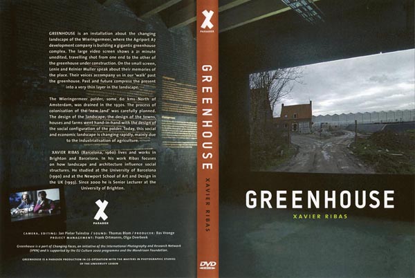
DVD published by Paradox
---
Installation Centro Huarte de Arte Contemporáneo, 2012
"Spanish artist Xavier Ribas's dual-channel video further explores how much the lens-based arts have changed since "New Topographics." Half of "Greenhouse" is a 20-minute video of a slow, rolling journey between two ends of a massive greenhouse construction site north of Amsterdam. The footage is as aloof as a video camera can be: unedited, and offering nary a pan, tilt, or zoom. The other half of "Greenhouse" is an interview with two landowners who sold their property to the developers. They recall all manner of context and history, recounting the reclamation of the land from the water and the Nazi invasion during World War II. While the artists of "New Topograhics" relied almost solely on the poetic mystery of images to make their statements, Ribas offers both a poem and a reason for why it was made."
[© Luke Strosnider, Nature as Artifice and New Topographics. This is Our Land. Rochester City Newspaper. Review of the exhibition Nature as Artifice at the George Eastman House in Rochester, New York]
+
Related files
PDF
Luke Strosnider, "This land is our land". Review of Nature as Artifice at George Eastman House, published in Rochester City Newspaper, 1st of July 2009 [En]
PDF
Nature and Artifice, George Eastman House, 2009 [En]
PDF
Nature and Artifice, Aperture Foundation, 2009 [En]
PDF Somewhere Between Fact and Fiction. Festival Loop Barcelona. Galeria ProjecteSD, 2007 [En] [Cast]
PDF
Cultured Nature. Stedelijk Museum Amsterdam. Curated by Hripsime Visser [En]
PDF
Neus Miró, Beyond Landscape. Arteleku 2010 [En]